KS3 Geography › Weather and climate

KS3 Geography › Weather and climate
These are the points the worksheet questions are built around.
Edinburgh sits on almost the same latitude as Moscow, yet a cold winter's day there is only around 4°C — nothing like the frozen winters found at similar latitudes in Canada. The reason is the UK's temperate maritime climate. Temperate means moderate, with no brutal heat or deep freeze, while maritime refers to the sea, which completely surrounds the UK. Ocean water warms up and cools down slowly, acting like a giant storage heater — holding onto warmth through winter and stopping the land from overheating in summer. Because the air reaching Britain has travelled over all that water, it arrives full of moisture, which is why the UK gets precipitation — rain, snow, hail, or sleet — in every single month of the year, with no reliably dry season.
The UK spans only around 1,000 kilometres from its south coast to the north of Scotland, but that's still enough to create a noticeable temperature difference, caused by latitude — how far north or south of the Equator a place is. Near the Equator, sunlight strikes at a concentrated, direct angle; further from it, the same energy spreads across a larger area at a shallower angle. Since Cornwall is closer to the Equator than Shetland, southern Britain receives more concentrated solar energy and runs warmer as a result.
Rainfall across the UK follows the shape of the land closely, because of altitude — height above sea level. Most of Britain's high ground sits in the west and north, including the Scottish Highlands, the Lake District, and the Welsh mountains. Moisture-laden air arriving off the Atlantic has nowhere to go but upward when it meets this high ground; as it rises, it cools, and since cold air holds less water vapour than warm air, that moisture condenses into cloud and falls as rain — a process called relief rainfall. This creates a dramatic contrast: parts of the western Highlands receive over 3 metres of rain a year, while parts of Essex get less than 600mm — roughly five times less. By the time that air has crossed the mountains, it has already lost most of its moisture, leaving eastern England in a rain shadow and making it some of the driest land in the country.
The east also experiences more extreme temperatures than the west, in both directions — warmer summers and colder winters. This comes down to the sea again: water takes a long time to warm up and releases heat slowly, while land heats up and cools down quickly. The west, fully exposed to the Atlantic, borrows the ocean's steadiness, giving it mild winters and cooler summers. Further east, that ocean influence weakens, letting the land behave more like land — hot in summer, cold in winter.
A final piece of the puzzle is air masses — huge bodies of air that take on the temperature and moisture characteristics of wherever they formed, then carry that character to wherever they travel. Their names describe what they bring: tropical means warm, arctic or polar means cold, continental means dry (having travelled over land), and maritime means wet (having crossed the ocean). Combining the two halves tells you what to expect — tropical maritime is warm and wet, polar continental is cold and dry. Since the UK sits at a crossroads where all of these air masses can reach it, and they don't blend smoothly, British weather can change repeatedly within a single day. In early 2018, for example, a cold continental air mass pushed in from the east and buried large parts of the country in snow, closing schools and roads and grounding flights for days.
In short: the UK's temperate maritime climate gives it mild temperatures and rain all year round. Latitude makes the south warmer than the north, altitude and Atlantic moisture make the west far wetter than the east (via relief rainfall and the rain shadow effect), and the sea's steadying influence keeps the west's temperatures more stable while the east swings between hotter summers and colder winters. On top of all this, competing air masses make British weather famously unpredictable.
These are the words that appear as key term cards in the video — worth knowing cold before the test.
Short clips from this lesson. Good for a quick refresh before a test.
Swipe sideways to see more →
Revising for a test? Key terms, objectives and quiz questions on one printable page.
The 3 questions from the video, one at a time. See if you caught them.
1. What does a temperate maritime climate give the UK?
Why: Temperate means moderate, with no extreme hot or cold, and maritime means influenced by the sea. So the UK has mild temperatures and rain all year round.
2. Which of these does NOT make a place in the UK wetter?
Why: High land, being on the west coast and air cooling as it rises all bring more rain. Being closer to the Equator doesn't make a place in the UK wetter.
3. Which side of the UK has the biggest gap between summer and winter?
Why: The east is further from the Atlantic, so the sea does less to keep its temperatures steady. That gives it hotter summers and colder winters than the west.
Score: 0 out of 3 —
Want more practice? Try the 60-second Quiz Challenge →
One page with a full answer key. Enough to check the lesson landed, and to see how the questions are written before you buy anything.
Get the free worksheet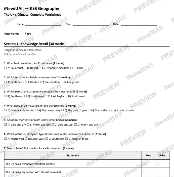
The top of page 1. The answer key is included when you buy.
£5 £6
The full worksheet and the extension pack together, with both answer keys.
Instant download with full answer keys. Print as many copies as your class needs.
£3
£3
£5 £6
Tick it off to track your progress. It's saved on this device. See my revision →
Students watch the video and do the quiz. They get a result card to paste back to you, showing their first try and best score.
This lesson's quiz questions on one sheet, with the answer key on page 2.
The quiz in big text for your classroom screen, one question at a time. Or build a 5-question Do Now starter from lessons your class has already done.
You're welcome to embed the video and link these resources in Google Classroom, Stile, Canvas, Compass or any other school platform. No need to ask.
Everything here is written to the KS3 curriculum for students aged 11–14. Print freely for the classes you teach.
 Next lessonClimate Change
More in this unit: Weather and climate
No spam, unsubscribe anytime. You must be 13 or over to sign up.